01 / G71M
Utility inspection routes
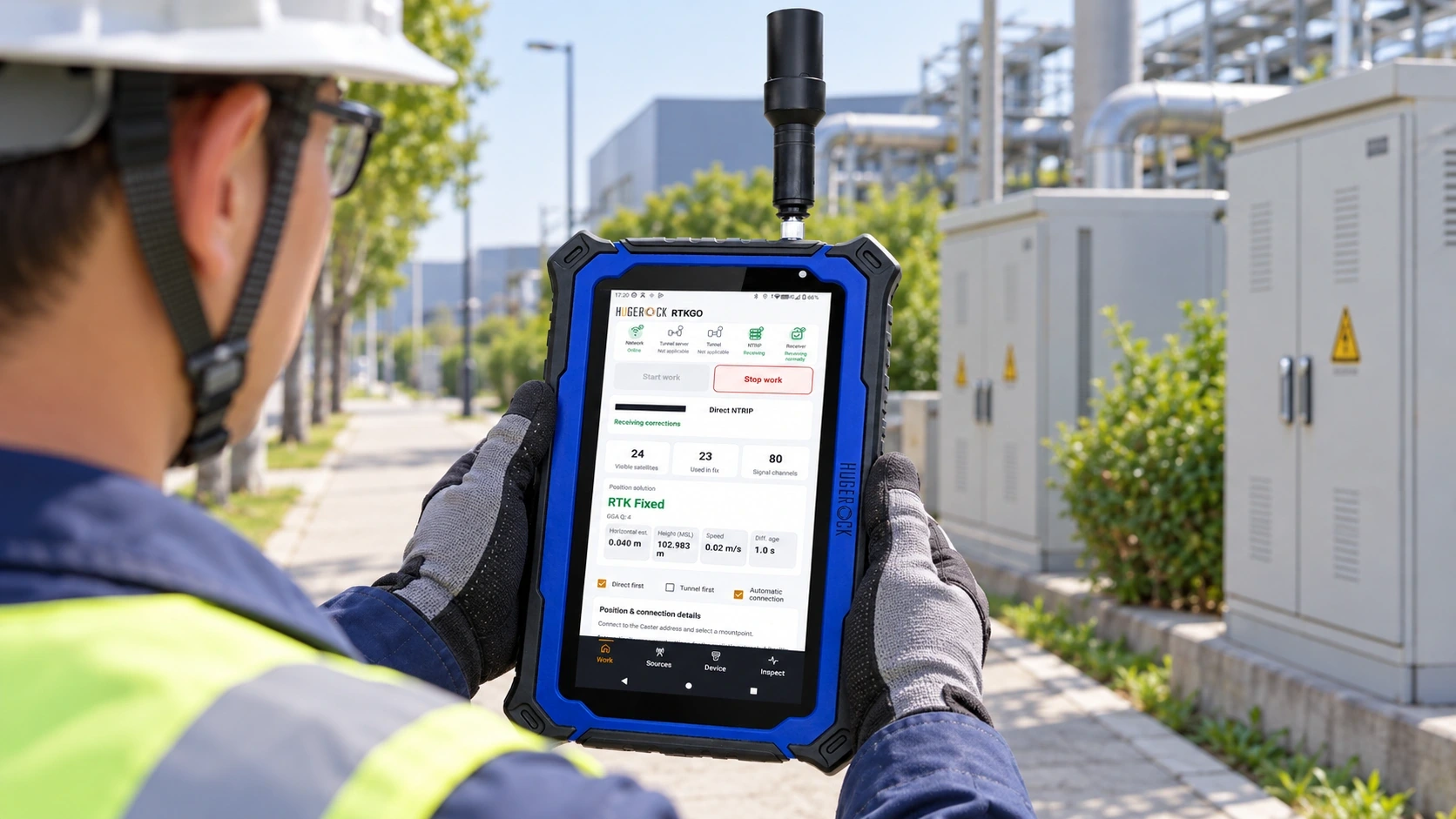
Keep asset positions and inspection records together. Validate receiver integration and export workflow.
Discuss this application ↗ RTKGO
Request a quote ↗
RTKGO
Request a quote ↗
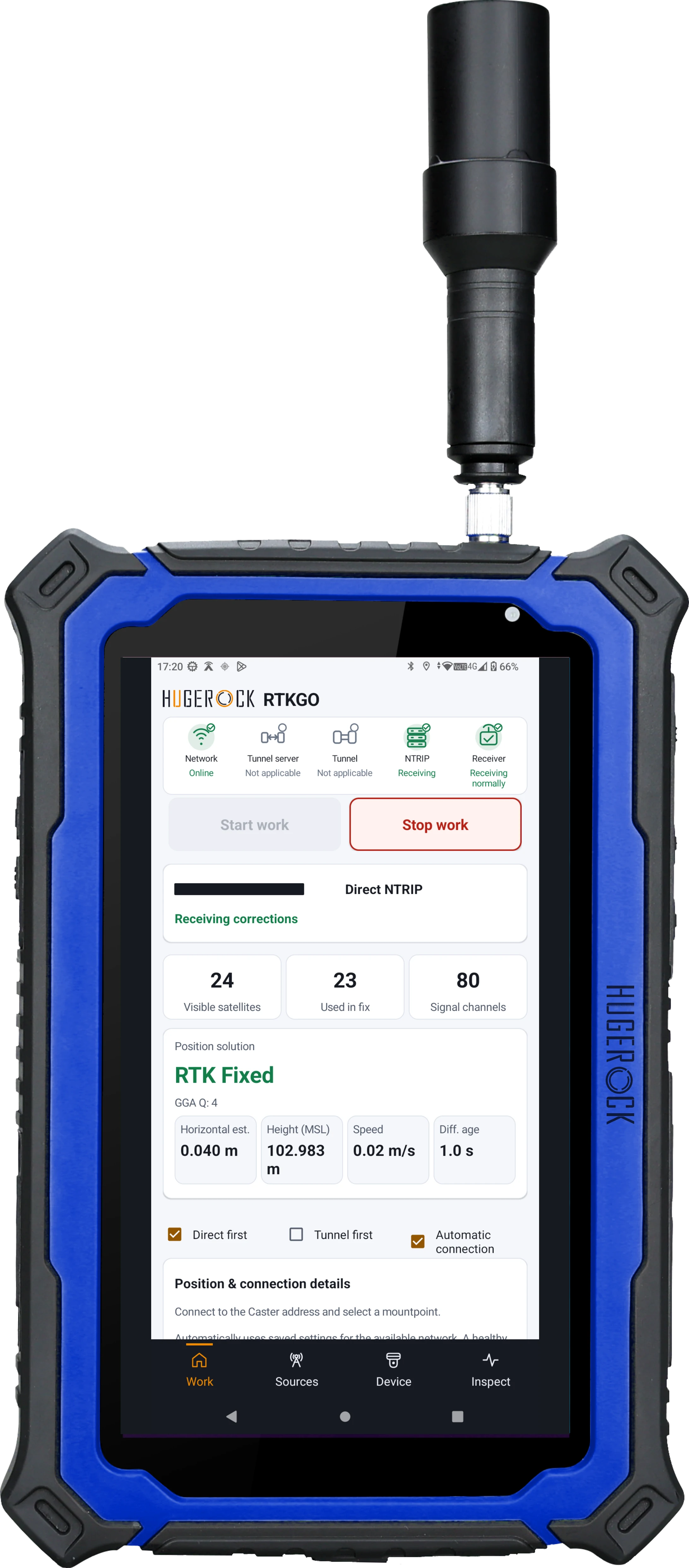
Explore the hardware, operating interface and application illustrations. Confirm antenna, mounting and software options in your quotation.
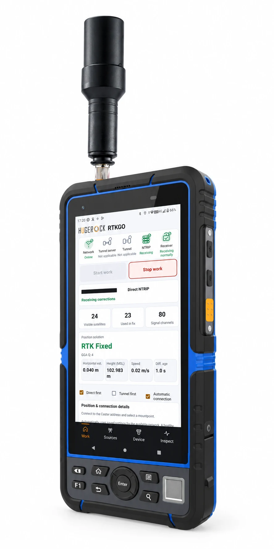
A rugged 7-inch portrait GNSS RTK tablet for GIS mapping, utility inspection and survey fieldwork. Its 2200-nit display gives map features and attribute forms a bright working surface for outdoor evaluation.
Model configuration: G71M. Confirm the antenna, receiver integration and installation scope.
Request a configuration-specific quotation
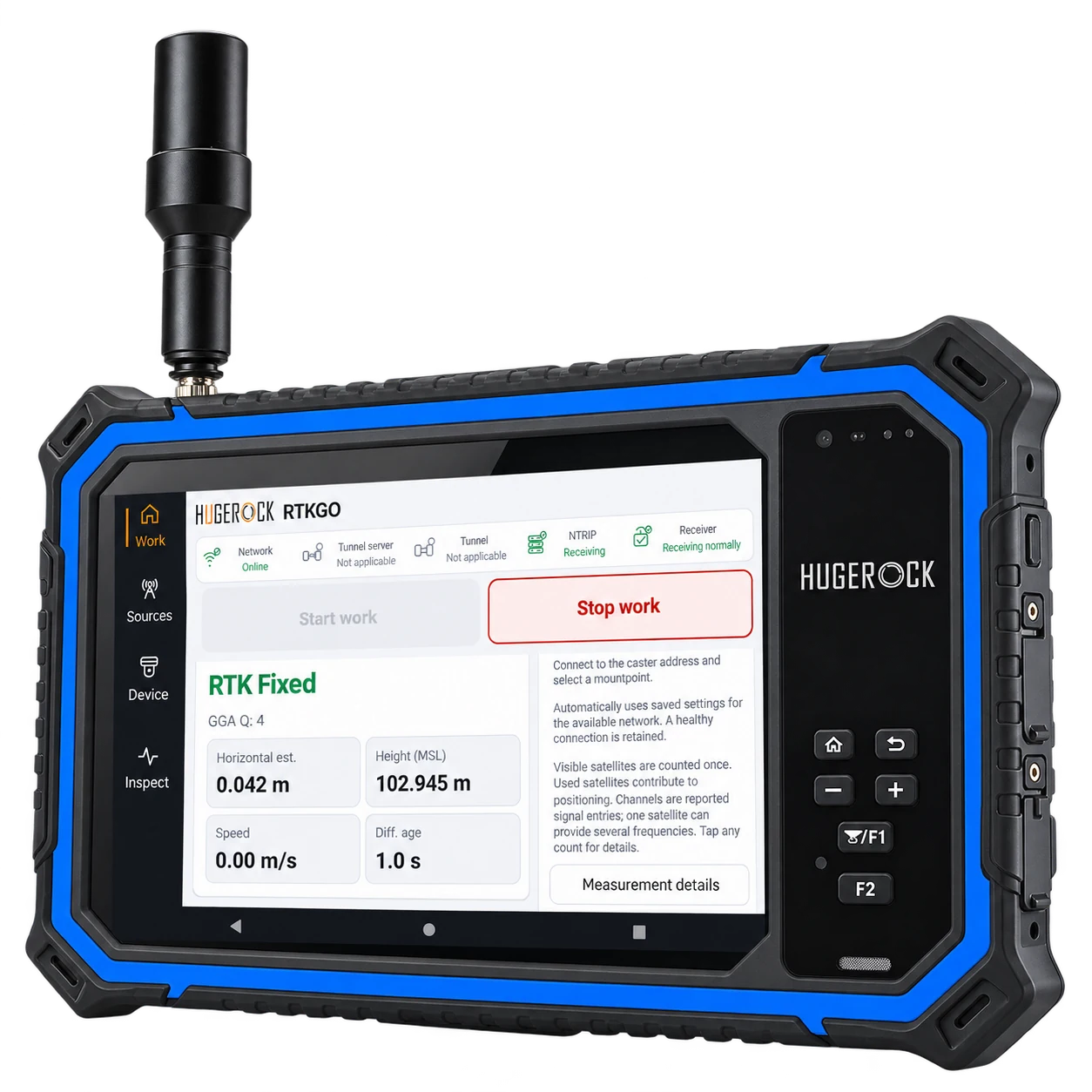
Choose G71M for a bright portrait workspace. Compare G60M for a smaller body or G80M for landscape work.
Choose G71M for a bright portrait workspace. Compare G60M for a smaller body or G80M for landscape work.
Confirm the Android version, receiver access, correction format, coordinate system and export workflow with your chosen software.
Agree the selected model, quantities, antenna, mounting, power, software and required support before ordering.
Ask about G71M ↗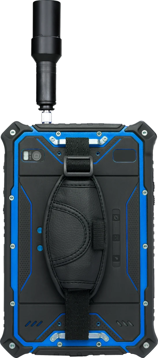
The rear hand strap supports a secure grip during field work. The RTK antenna is positioned on the top edge, clear of the protective corner.
10000mAh
USB Type-C OTG / Type-C charging; SIM; microSD; 3.5mm audio
Battery capacity is not a runtime guarantee. Input and adapter ratings are not measured operating consumption.
Use these application examples to define the site, reference source, field software and installation requirements for your quotation.
Keep asset positions and inspection records together. Validate receiver integration and export workflow.
Discuss this application ↗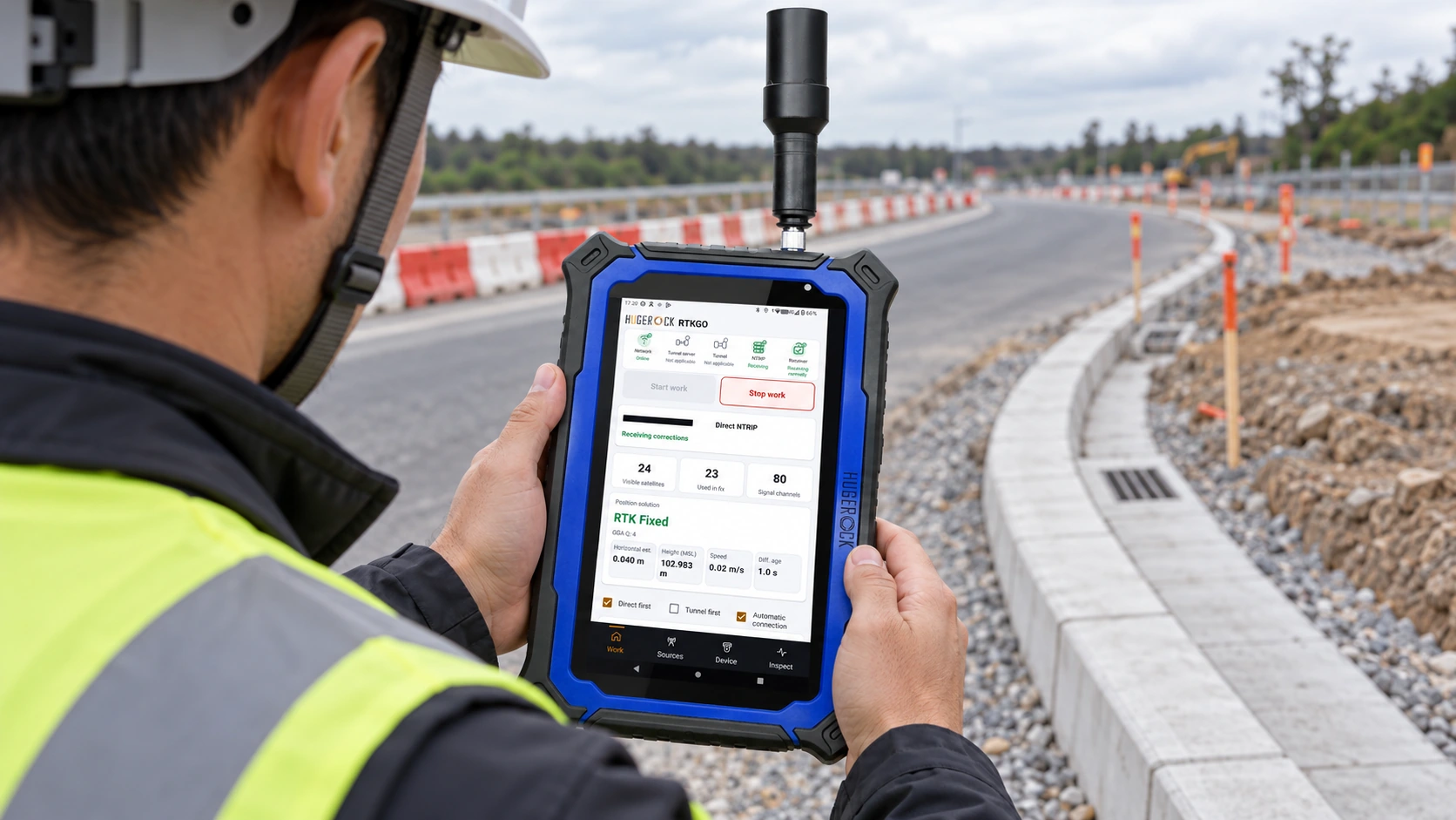
Use a documented reference source for field checks. Agree the coordinate system and point acceptance criteria.
Discuss this application ↗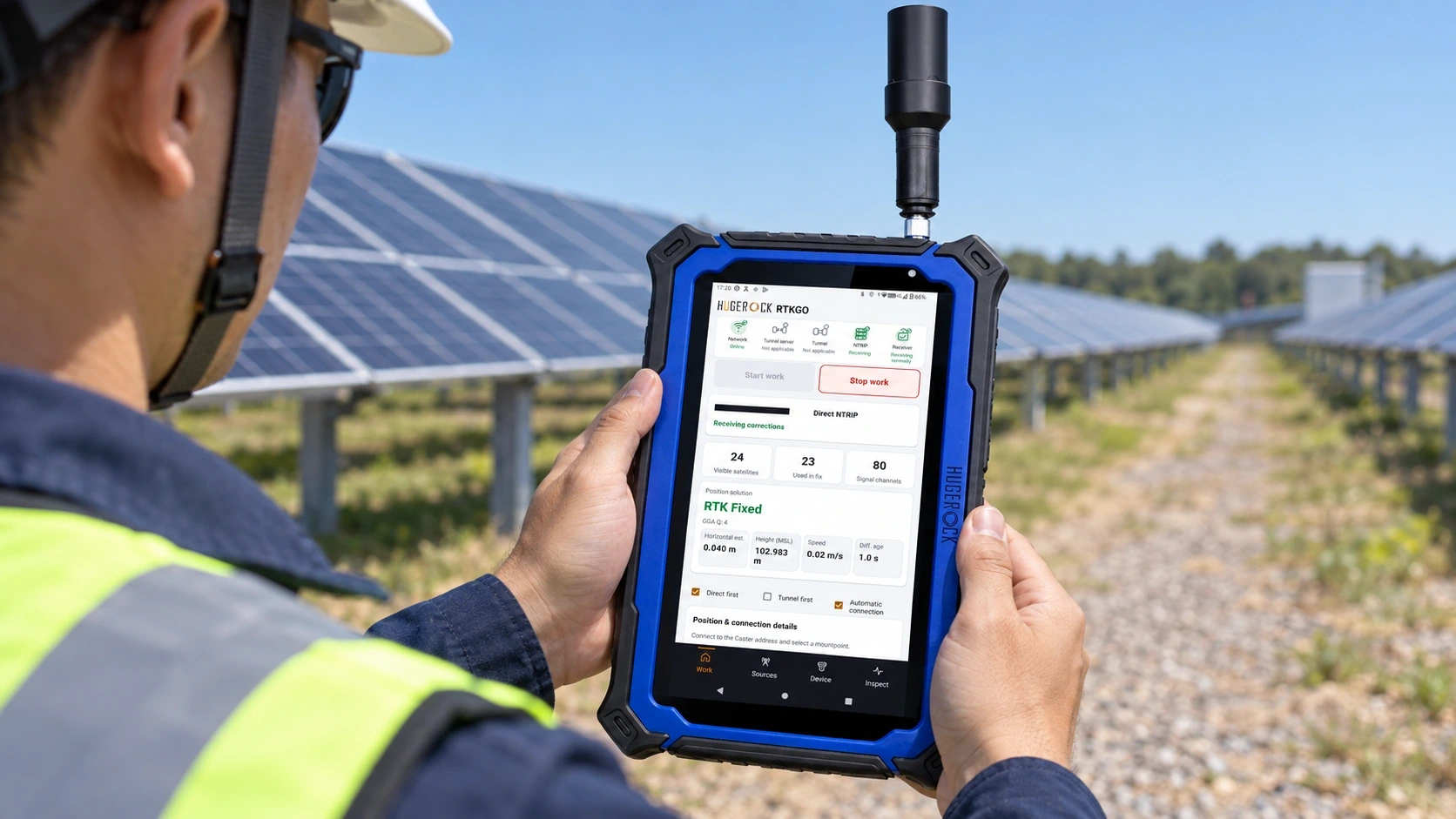
Link inspection observations to field positions. Evaluate display readability and your reporting application.
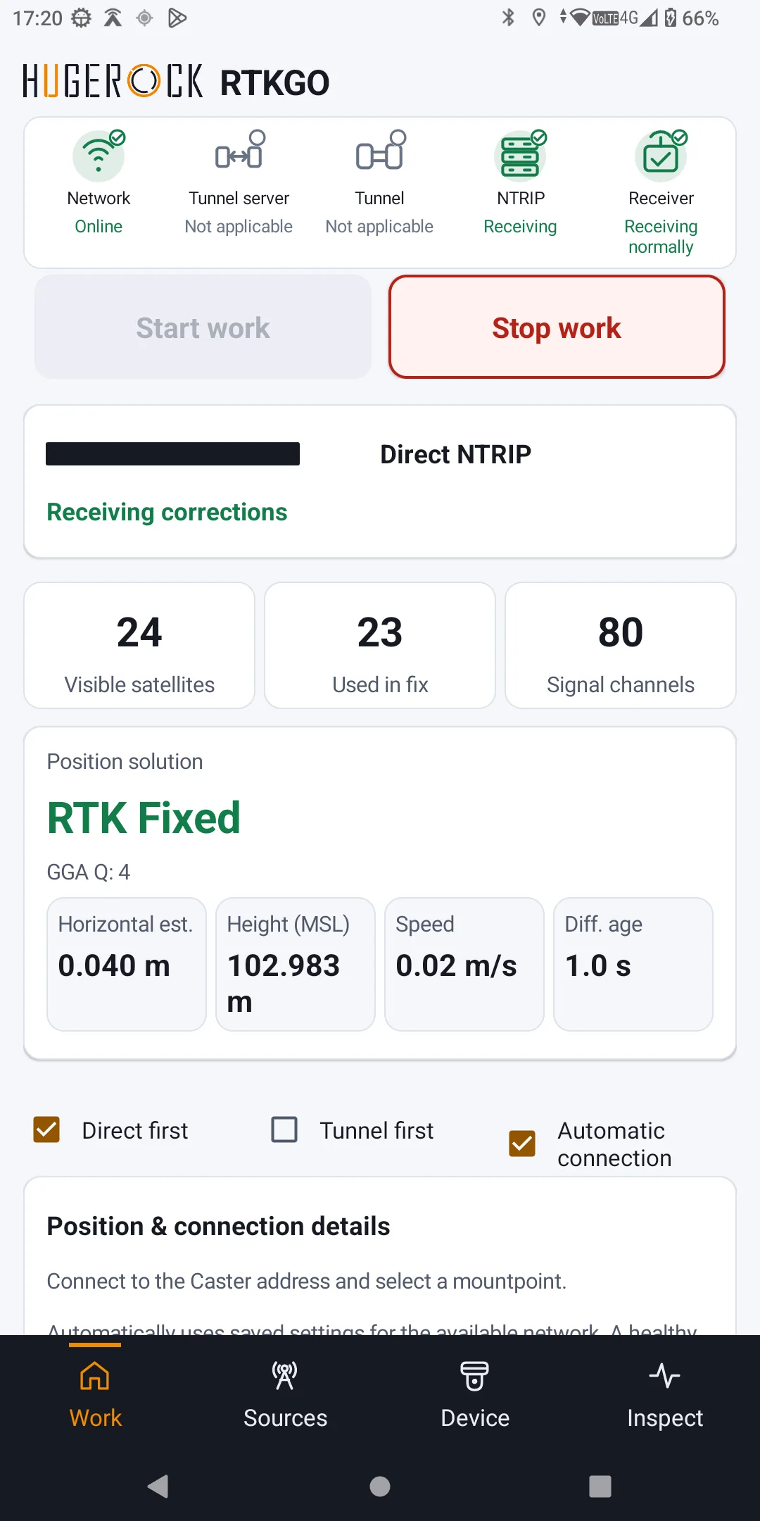
Discuss this application ↗Review correction-service health and positioning status in RTKGO. Values depend on the receiver, site and reference service.
GB30 combines a local reference base and Caster. Use a suitable local or uplink source for the project and verify the client-side data path.
Tunnel access needs ordinary internet and compatible software. Source selection does not imply automatic nearest-station selection or seamless roaming.
Explore the GB30 reference platform →| Processor | ARM Cortex-A73 octa-core, 2.0GHz |
|---|---|
| Graphics | ARM Mali-G72 MP3 |
| Memory / storage | 8GB RAM / 128GB storage |
| Cameras | 13MP rear AF with flash / 5MP front |
| Cellular | 4G LTE; GSM / WCDMA / VoLTE |
| Wi-Fi | Dual-band 2.4/5GHz, 802.11 a/b/g/n/ac |
| Bluetooth | 5.0 LE |
| Operating system options | Android 9 / 10 / 11 / 13; OS version specified with your order |
| Operating temperature | -20°C to +55°C |
| GNSS channels | 1408; NebulasIV architecture |
| GNSS tracking | BDS B1I/B2I/B3I/B1C/B2a/B2b*; GPS L1C/A/L1C*/L2P(Y)/L2C/L5; GLONASS G1/G2/G3*; Galileo E1/E5a/E5b/E6*; QZSS L1/L2/L5 |
| RTK accuracy (CEP) | P: 0.8cm + 1ppm; E: 1.5cm + 1ppm |
| Single-point accuracy (CEP) | P: 1.5m; E: 2.5m (with SBAS) |
| GNSS update rate | 20Hz |
| Correction data | RTCM V3.X |
| Output | NMEA-0183 / Unicore |
| Cold / hot / aided start | <30s / <20s / <1s |
| Inertial navigation | None |
| External helix antenna | Multi-frequency; Ø27.5 × 107.5mm; SMA 90-degree omnidirectional; 33 ±2dB gain |
| Protection | IP67; MIL-STD-810G method 516.6 procedure IV; touch panel IK05 |
| Warranty | 24 months; battery 12 months |
| Display | 7-inch IPS/AFFS; 1080 × 1920; 2200 nits |
| Battery / power | 10000mAh |
| Dimensions | 202 × 131 × 21mm |
| Weight | 700g |
| Interfaces | USB Type-C OTG / Type-C charging; SIM; microSD; 3.5mm audio |
| Expandable storage | microSD, up to 1TB |
Accuracy specifications apply under the stated measurement and baseline conditions. Confirm your operating requirements before deployment.
Operating system version, software, accessories and final hardware configuration must be specified in the quotation.
Choose G71M for a bright portrait workspace. Compare G60M for a smaller body or G80M for landscape work.
Carry the model, quantity and installation needs into an enquiry. Accessories and integration are quoted separately once the scope is confirmed.
G71M / RTK configuration
Confirm package contents, accessories, application licensing, integration, network services, tax and freight in the final quotation.
Carry configuration into enquiry ↗Final configuration and commercial terms are provided in the project quotation.Product specifications, applications and ordering information. English edition, 2026-10-17.
Download PDF ↓PDF / SOFTWARE USER GUIDELearn how to connect correction sources, configure the receiver and check positioning status in RTKGO.
Download English user manual ↓Confirm the selected SKU, antenna, strap or bracket, power supply, software licensing and service terms in the quotation.
Positioning accuracy depends on reference coordinates, baseline, sky visibility, antenna setup and correction age. Validate results against independent check points and your project requirements.
Evaluate the application against the supplied Android version, GNSS access method, supported data outputs and correction workflow. Confirm application licensing and compatibility in your evaluation.
 Request a quotation ↗
 Request a quotation ↗
G71M suits field teams that review a map while completing inspection forms and asset attributes. Compare its 7-inch portrait workspace with G60M for portability and G80M for landscape map review.
The selected G71M has a 7-inch portrait display rated at 2200 nits, physical controls and a rear hand strap. Evaluate actual readability with your map styling, weather and working position.
Specify the required field application, licence and GNSS integration in the quotation. RTKGO provides correction-connection and positioning status; GIS capture functions depend on the selected application.